Last reviewed: 17 November 2026. Distances come from Christchurch City Council, DOC and NZ Running’s own measured routes, and they’re approximate. Check track status before you head onto the Port Hills, because tracks can close for fire risk, slips or maintenance.
Christchurch is one of the best cities in New Zealand for running. The city is almost completely flat, with long riverside and coastal paths, and the Port Hills rise straight out of the suburbs with great trail running close to town.
Here are the routes worth knowing, from an easy loop of Hagley Park to the Crater Rim. Browse all our Christchurch running routes, or if you’re visiting from up north, see the best running routes in Auckland too.
A quick note on distances: our route pages are GPS-measured, so they can differ slightly from council and DOC figures. Where the sources disagree, we give a range.
Christchurch running routes at a glance
| Route | Distance | Terrain | Best for |
|---|---|---|---|
| Hagley Park | North loop about 4 to 4.5 km, South loop about 3.6 to 3.7 km; outside of both parks 6.5 km | Flat paths | Easy runs, intervals, first-timers |
| Te Ara Ōtākaro Avon River Trail | About 11 km one way | Flat riverside paths | Long easy runs, city to sea |
| Christchurch Coastal Pathway | About 6.3 to 6.5 km one way (about 13 km out and back) | Flat, sealed shared path | Sunrise runs, sea views |
| Heathcote River Trail | About 14 km one way | Flat shared paths, some grass verges, narrow unsealed lower section | Long runs with variety |
| Bottle Lake Forest (Blue Track) | About 10 to 11.4 km loop | Flat forest tracks, almost all in shade | Shade on hot days, easy trail |
| Rāpaki Track | About 7 km out and back, about 260 m climb | Gravel and part-sealed farm track | Hill training |
| Bridle Path | 2.4 km one way (5 km out and back), about 320 m climb | Wide, steep, part-rocky track | Short, hard climb |
| Godley Head Loop | About 8 to 9 km loop, about 270 m climb | Gravel coastal track, steady ups and downs | Big coastal views, trail running |
| Kennedys Bush Track | About 7 km return | Steady climb to Summit Road | Long, steady climbs |
| Crater Rim Walkway | About 27 km point to point (or run it in sections) | Formed gravel, open tussock, rocky sections | Experienced trail runners |
Flat city routes
Hagley Park
Hagley Park is the heart of running in Christchurch: 165 ha of flat, central parkland right beside the city centre. Our Hagley Park perimeter loop runs 6.5 km round the outside of both North and South Hagley.
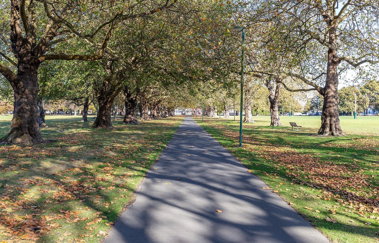
Hagley Park, Christchurch. Photo: Michal Klajban, CC BY-SA 4.0, via Wikimedia Commons.
If you’d rather do one half at a time:
- North Hagley: the council’s North Hagley Park Walk is a 4 km loop from the Armagh Street car park, and it suits wheelchairs and strollers.
- South Hagley: the South Hagley Park Walk is a 3.6 km loop from the Hagley Oval car park on Riccarton Avenue.
The council’s Hagley Park page gives the perimeter paths as 4.5 km (North) and 3.7 km (South). Depending on your line, each loop is about 4 to 4.5 km and about 3.6 to 3.7 km, so doing both loops comes to roughly 8 km. For a longer run, add the Botanic Gardens paths.
There are toilets at the Armagh Street car park and on Deans Avenue. The council’s Hagley Park map also shows water fountains and a fitness trail.
North Hagley is home to a free parkrun every Saturday at 8:00am. See our Hagley parkrun listing.
Te Ara Ōtākaro Avon River Trail
The Te Ara Ōtākaro Avon River Trail follows the Avon River for about 11 km one way. It starts at Cambridge Village Green in the central city (corner of Barbadoes Street and Cambridge Terrace) and runs to Pages Road in New Brighton. It’s flat, and you can turn around whenever you like.
Alongside the river, the council is building the City to Sea Pathway, a 4 m wide all-weather shared path. Here’s where it’s up to:
- Open: the first section, 4.5 km from Cambridge Village Green to Avon Park.
- Newly open: City to Sea East, from Porritt Park to the Anzac Drive (SH74) underpass in Avondale, opened in late October 2026. It’s a 3.5 km asphalt shared path with two drinking fountains.
- Watch the tide: the Anzac Drive underpass floods at high tide. A signposted high-tide detour along Anzac Drive and Wainoni Road has been proposed.
- Still to come: work on the final stage, from Anzac Drive to Pages Road, is expected to start in early 2027 and finish in 2029, opening in sections. When finished, the full pathway will run about 11 km from Barbadoes Street to Pages Road.
Christchurch Coastal Pathway
The Christchurch Coastal Pathway (Te Ara Ihutai) is a 6.5 km shared path from Ferrymead Bridge to Scarborough Park at Sumner Beach, via Mt Pleasant, Redcliffs, Moncks Bay, Shag Rock/Rapanui and Cave Rock. Our Coastal Pathway route measures it at 6.3 km, flat and sealed. It’s a great sunrise run. Go out and back for about 13 km, or link it with the Heathcote River Trail at Ferrymead Bridge for a long run.
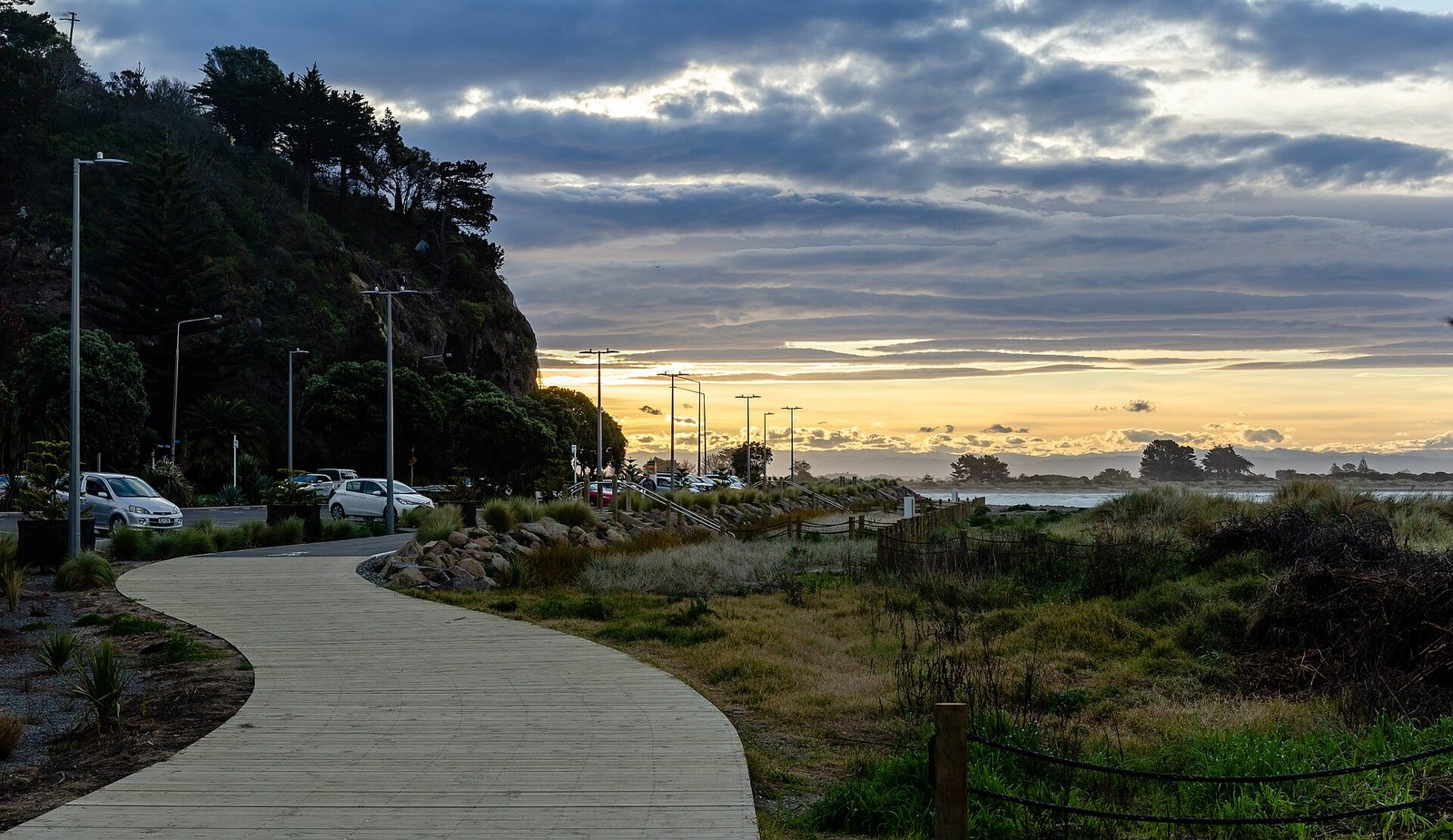
The path to Sumner Beach, at the Sumner end of the Coastal Pathway. Photo: Michal Klajban, CC BY-SA 4.0, via Wikimedia Commons.
Heathcote River Trail
The Heathcote River Trail (Ōpāwaho) runs about 14 km. It starts at the corner of Cashmere and Ferniehurst Streets in Cashmere and finishes just before the Ferry Road roundabout in Ferrymead. Many sections are shared use, and a couple of areas use grass verges next to quiet roads.
The lower section is a narrow unsealed path. The path under the SH74 Tunnel Road bridge can flood at high tide, so check the tides if you’re heading to the estuary end. The trail is easy to split into shorter sections. To keep going to Sumner, join the Coastal Pathway at Ferrymead Bridge.
Bottle Lake Forest Park
On the city’s eastern edge, Bottle Lake Forest Park (Waitākiri) is about 800 ha of exotic pine forest. The Blue Track is a flat loop from the Bottle Lake Forest car park on Waitikiri Drive, Parklands. The council lists it as 10 km, ChristchurchNZ gives 11.4 km and our Blue Track route measures 10.8 km.
The tracks are almost entirely in shade, which makes this the place to run on a hot day. A few things to know: